Sea Kayak Adventure Group

Ocean Litereacy International (Hong Kong)

Scientists Warn: Nine Climate Tipping Points Now ‘Active’ – Could Threaten the Existence of Human Civilization

Global Warming Threatens Human Civilisation

By UNIVERSITY OF EXETER

NOVEMBER 30, 2019

More than half of the climate tipping points identified a decade ago are now “active,” a group of leading scientists have warned.

This threatens the loss of the Amazon rainforest and the great ice sheets of Antarctica and Greenland, which are currently undergoing measurable and unprecedented changes much earlier than expected.

This “cascade” of changes sparked by global warming could threaten the existence of human civilizations.

Evidence is mounting that these events are more likely and more interconnected than was previously thought, leading to a possible domino effect.


“We must admit that we have underestimated the risks of unleashing irreversible changes, where the planet self-amplifies global warming.” — Johan Rockström, Potsdam Institute for Climate Impact Research

In an article published in the journal Nature on November 27, 2019, the scientists call for urgent action to reduce greenhouse gas emissions to prevent key tipping points, warning of a worst-case scenario of a “hothouse,” less habitable planet.
“A decade ago we identified a suite of potential tipping points in the Earth system, now we see evidence that over half of them have been activated,” said lead author Professor Tim Lenton, director of the Global Systems Institute at the University of Exeter.

“The growing threat of rapid, irreversible changes means it is no longer responsible to wait and see. The situation is urgent and we need an emergency response.”

Co-author Johan Rockström, director of the Potsdam Institute for Climate Impact Research, said: “It is not only human pressures on Earth that continue rising to unprecedented levels.
“It is also that as science advances, we must admit that we have underestimated the risks of unleashing irreversible changes, where the planet self-amplifies global warming. This is what we now start seeing, already at 1°C global warming.
“Scientifically, this provides strong evidence for declaring a state of planetary emergency, to unleash world action that accelerates the path towards a world that can continue evolving on a stable planet.”

In the commentary, the authors propose a formal way to calculate a planetary emergency as risk multiplied by urgency.  Tipping point risks are now much higher than earlier estimates, while urgency relates to how fast it takes to act to reduce risk.

Exiting the fossil fuel economy is unlikely before 2050, but with temperature already at 1.1°C above pre-industrial temperature, it is likely Earth will cross the 1.5°C guardrail by 2040. The authors conclude this alone defines an emergency.

Nine active tipping points:

Arctic sea ice
Greenland ice sheet
Boreal forests
Permafrost
Atlantic Meridional Overturning Circulation
Amazon rainforest
Warm-water corals
West Antarctic Ice Sheet
Parts of East Antarctica
The collapse of major ice sheets on Greenland, West Antarctica and part of East Antarctica would commit the world to around 10 meters of irreversible sea-level rise.

Reducing emissions could slow this process, allowing more time for low-lying populations to move.

The rainforests, permafrost, and boreal forests are examples of biosphere tipping points that if crossed result in the release of additional greenhouse gases amplifying warming.

Despite most countries having signed the Paris Agreement, pledging to keep global warming well below 2°C, current national emissions pledges — even if they are met — would lead to 3°C of warming.

Although future tipping points and the interplay between them is difficult to predict, the scientists argue: “If damaging tipping cascades can occur and a global tipping cannot be ruled out, then this is an existential threat to civilization.

“Scientifically, this provides strong evidence for declaring a state of planetary emergency.” — Johan Rockström

“No amount of economic cost-benefit analysis is going to help us. We need to change our approach to the climate problem.”

Professor Lenton added: “We might already have crossed the threshold for a cascade of inter-related tipping points.

“However, the rate at which they progress, and therefore the risk they pose, can be reduced by cutting our emissions.”

Though global temperatures have fluctuated over millions of years, the authors say humans are now “forcing the system,” with atmospheric carbon dioxide concentration and global temperature increasing at rates that are an order of magnitude higher than at the end of the last ice age.

###

Reference: “Climate tipping points — too risky to bet against: The growing threat of abrupt and irreversible climate changes must compel political and economic action on emissions.” by Timothy M. Lenton, Johan Rockström, Owen Gaffney, Stefan Rahmstorf, Katherine Richardson, Will Steffen and Hans Joachim Schellnhuber, 27 November 2019, Nature.
DOI: 10.1038/d41586-019-03595-0

The latest UN Climate Change Conference will take place in Madrid from December 2-13.

South Lamma Island – Circumnavigation

remote beaches to sea kayak to

An exposed coast with few takeout places

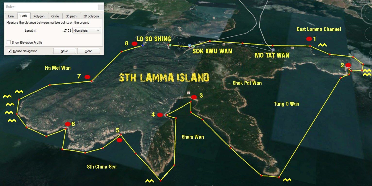
STH lamma island sea kayak route map

SOK KWU WAN to Lo So Shing Village Beach – east to west sea kayak journey

This trip route will vary (possibly a lot) depending on the tide, wind and ocean conditions on the day. Do not attempt to paddle this section of the Hong Kong coast unless you can self-rescue. There are very few escape routes.

As this trip is 17 klms from start to finish, if you don’t go into beautiful Shek Pai Wan, which would add an extra 3 klms. If the sea, wind and tide conditions are favourable, its a very rewarding to paddle along a largely unknown stretch of the Hong Kong coastline.

So by the numbers:

1. Lo So Shing Village Beach to the East Lamma Channel – 2.58 klms / 40 minutes.
Sok Kwu Wan is a sheltered bay protected on 3 sides by high hills, so unless the wind is coming from the NE, you will not know how strong it is, until you leave the bay.

Point 1 to Point 2 – East Lamma Channel.to Sth Lamma Sea Tunnel – 1.71 klms / 20 mins
The are 2 places in this section that have tidal waves and strong currents, indicated on the map by the yellow wavey lines.These areas can have very confused water at peak tides. 

East Lamma Channel

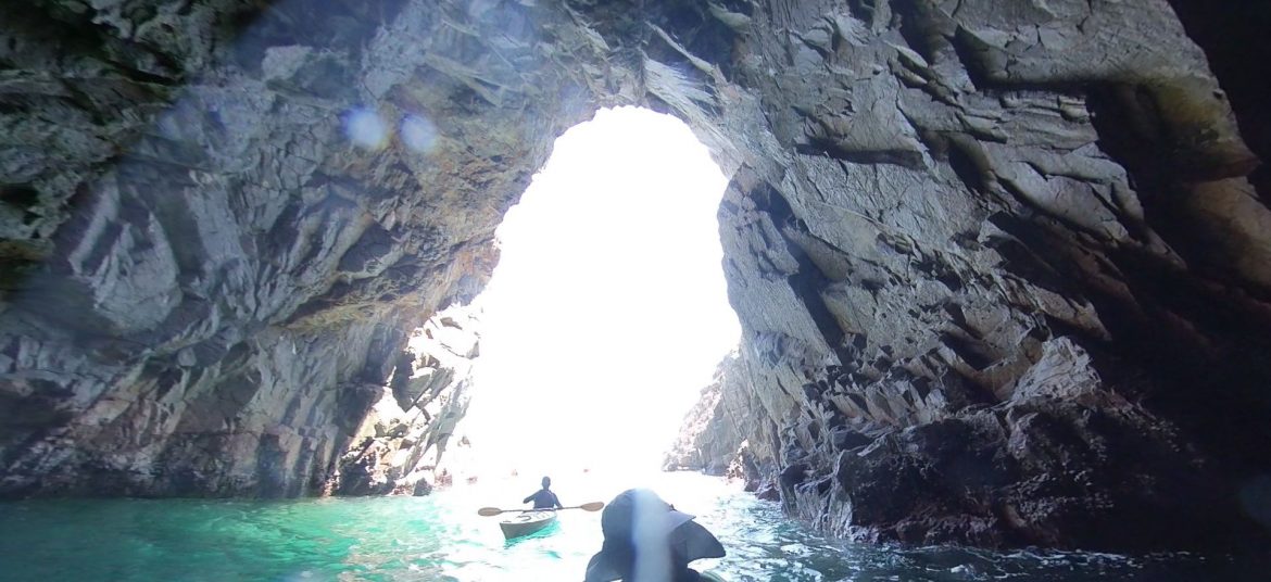
Just around the headland, if the waves are small, you can explore in close to the cliff face and you will find a surprise – there is a tunnel wide enough to paddle through. This is very easy to miss.

Point 2 to Point 3 – Sea tunnel to Sham Wan beach – 4.76 klms / 60 minutes.
The crossing from the sea tunnel to Sham Wan Headland is relatively straight forward, if you are travelling with the tide. It will take between 30 and 40 minutes, but if the tides are against, this could easily take twice as long.Once you are around the headland and enter Sham Wan (Deep Bay) you gain the protection of the headlands on both sides and quickly find yourself in a sheltered bay (except if the winds are blowing from the south).

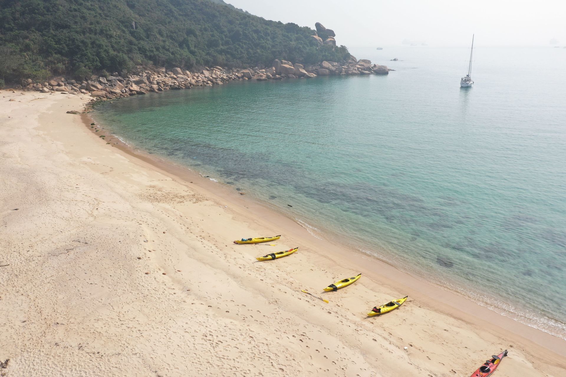
The paddle into Sham Wan will take 20 minutes. From July to October the beach is closed to visitors due to the Green Sea Turtle breeding season.Do not land on the beach, instead, paddle 5 minutes back across the bay to a small beach on the opposite side. A great place to swim and have lunch. There is shade too.


Sea Kayak Hong Kong destinations_38

Take your time to have a swim if it is a warm day as there is no place to exit for another 1 hour after departing the lunch beach.


Sea Kayak Hong Kong destinations_33

Point 4 to Point 5 – Sham Wan lunch spot to sea caves around west Sham Wan Headland -2.0 klms / 30 minutes.

Leaving Sham Wan you are again exposed to rugged cliffs and a long headland that juts out into the South China Sea. Here there can be large swells and cross currents depending on the tide. Paddle hard around the headland into the bay behind. You will see a series of cliffs with dark spaces along them. These are sea caves that are worth a visit if the conditions are good.

Point 5 to Point 6 – .Sea cliffs to the waterfall cave – 1.2 klms / 15 mins paddle.
This section is steep sea ciffs all the way. Once around the headland you will see a valley in front of you and what appears to be a dark cleft in the rocky shore. As you paddle towards it, there will be a small waterfall appear (15m) if there has been recent rain. If it is dry, there will be a narrow gap in a cliff appear. This gap is about 4 meteres wide and goes back into a cave that is 30 meters deep, with a steep sandy beach inside. If the water fall is running, you cannot see the cave or the beach. 
NB: you can kayak into this cave and land on the bech if the waves are small. DO NOT go into the cave if the waves are 1/2 meter of greater as you cannot turn around inside and the shorebreak can capsize you when you have to reverse out again.

Point 6 to Point 7 – Waterfall Cave to Millionaires Beach – 2.52 klms / 30 to 120 minutes!!!
This section of the route has the potential of being the most difficult, depending on tide and swell. The cliffs and rocky shores do not allow for a safe landing until you are around the final headland.However, the headland can have a very strong tidal race for about 300 meters. If that is with you, this is a very simple rounding, but if that is against you, it is sometimes faster than you can paddle and will make the section very tiring. Time your journey well!!

Point 7 to Lo So Shing Beach – 1.41 klm / 20 minutes
An easy paddle north to the first beach, however this is a governemnt gazetted beach so it is prohibitted to land there during the swimming season so ensure that you stay close to the southern bank as you addle in. There is a rocky headland with BBQ pits. There is a series of steps leading to the water there. It is a difficult take out poit. Most often it is better to paddle onto the beach and hope that the life guards understand. 

From here the kayaks have to be carried up the stairs at the back of the beach and then trolleyed back to Lo So SHing Village beach – approximately 300m and about 15 minutes hike..


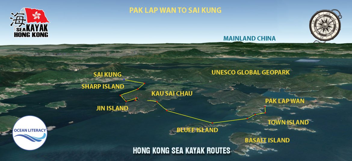
Pak Lap Wan to Sai Kung Village

Bluff Island Sea Arch

An short, fun and beautiful seakayak trip.

Pak Lap to Sai kung sea kayak route

Sai Kung to Pak lap Wan – on a north bound journey OR Pak Lap Wan to Sai Kung on a south bound journey.

This trip route will vary (possibly a lot) depending on the tide, wind and ocean conditions on the day. Do not attempt to paddle this section of the Hong Kong coast unless you can self-rescue. There are no easy escape routes.

Tung Lung Chau to Clearwater bay_10

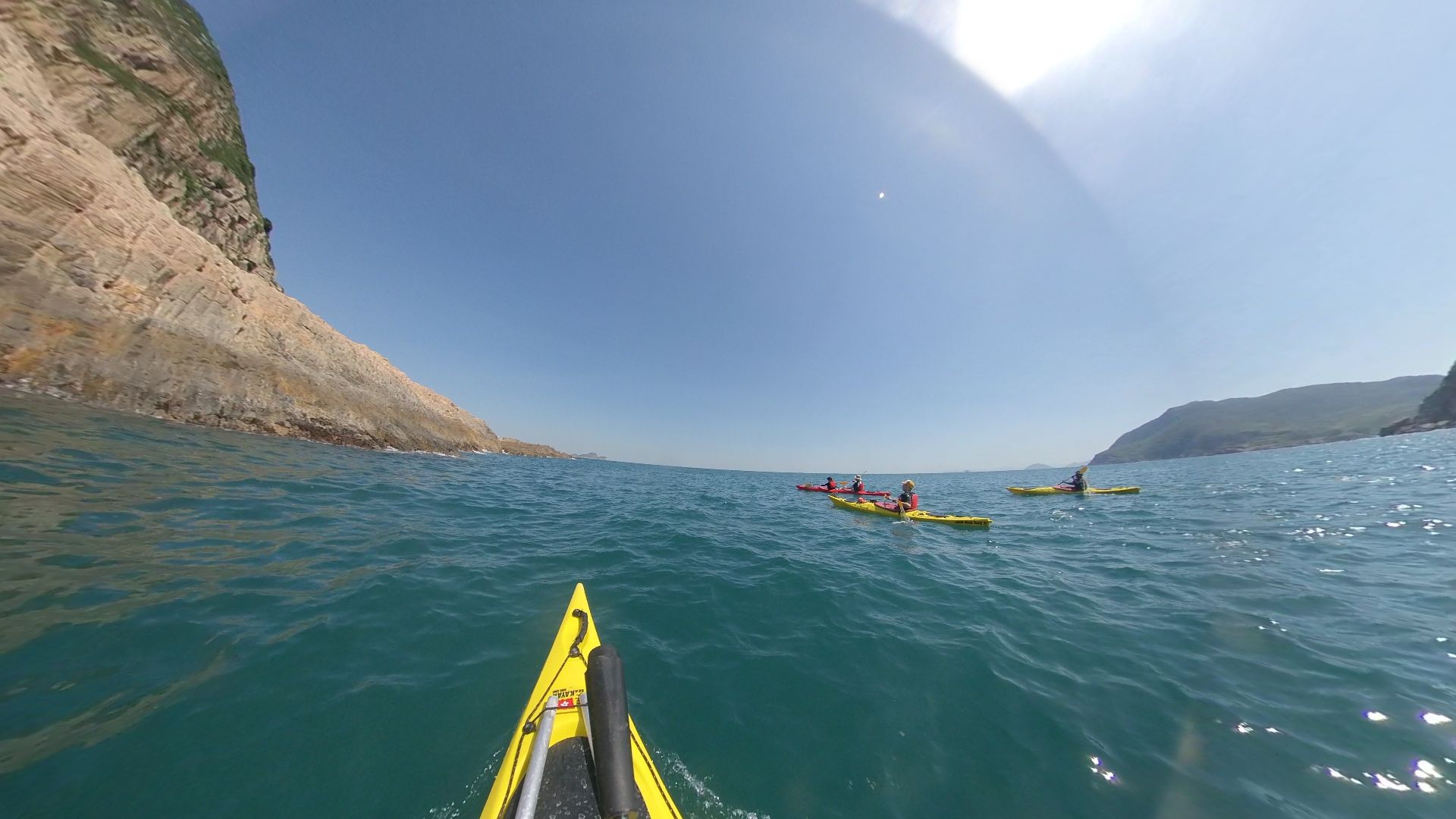
As this trip is only about 6 klms. If the sea conditions are favourable, its great to paddle into some of the majestic bays and sea caves on the eastern section of the Tung Lung Chau coast before heading north to Clearwater Bay. You also get to see the climbers who scale these cliffs.

Leaving Tung Lung Chau heading north, its a short 500m paddle to the mainland coast, but be aware that this is a busy shipping channel. A major pleasure marina is just around the headland so on a weekend there are hundreds of recreational boats passing through. Keep your eyes peeled for incoming vessels, both left & right.

u00a0

Tung Lung Chau to Clearwater bay_15

From here the cliffs and the hidden nooks and crannies are well worth exploring (depending on sea swells and wind direction of course). There are a number of caves that have been formed along the weaknesses caused by the formation of the volcanic tuff (the reason for the UNESCO listing as a Global Geopark).u00a0

As the constant battering of the waves and swells pounded the vertical columns, the weakest places have let go. Sitting in a kayak on an undulating sea makes you wonder at the power of those waves to cut open these cliffs into such awe inspiring features.

This sea coast is formidable. Make sure that you take opportunities to expore as they arise, but don’t take risks, and always keep an eye over your shoulder for the rogue wave from passing ships or cruisers.

Once inside the more protected waters of Shelter Bay, the coastlines becomes more subdued. The human development on the shores and hillsides are pretty obvious. Within 1 km you are paddling passed the entrance to a very overstated marina development for the uber wealthy of Hong Kong. The attitude of the boat captains can sometimes leave a lot to be desired, so make sure you are obvious and be humble in your attitude to ownership of the ocean on which you paddle and share.u00a0

u00a0

SEA arches of Hong Kong

Entering into Clearwater Bay you are greeted with pleasure vessels of many shapes and sizes. It gives you a sense of acheivement when you realise you have handled the same seas in your small, self-contained sea craft as the multi-million dollar vessels that are at anchor in what must once have been a pristine bay with sea turtles, coral reefs, tropical fish, sea mammals and an abundance of sea life. Today, we have a great place to swim. The ocean is clean and blue, a remnant of bygone days in Hong Kong.u00a0u00a0

The take out point is a long stair climb, maybe 150 steps to an awaiting carpark. The bus leaves here for Hong Kong districts too.

A fantastic paddle for those who want something spectacular and relatively short.

As always, stay safe!

Tung Lung Chau to Clearwater Bay

Tung Lung Chau to Clearwater bay_20

An short, fun and beautiful seakayak trip.

tung-lung-chau-to-clearwater-bay-2

It’s difficult to get to Tung Lung Chau (only by boat) so you would have probably paddled there already – from the previous north bound route – Shek O to Tung Lung Chau.

This trip can either be very easy or extremely difficult depending on tide, wind and ocean conditions. Do not attempt to paddle this section of the Hong Kong coast unless you can self-rescue. There are no easy escape routes.


Tung Lung Chau to Clearwater bay_10

As this trip is only about 6 klms. If the sea conditions are favourable, its great to paddle into some of the majestic bays and sea caves on the eastern section of the Tung Lung Chau coast before heading north to Clearwater Bay. You also get to see the climbers who scale these cliffs.

Leaving Tung Lung Chau heading north, its a short 500m paddle to the mainland coast, but be aware that this is a busy shipping channel. A major pleasure marina is just around the headland so on a weekend there are hundreds of recreational boats passing through. Keep your eyes peeled for incoming vessels, both left & right.


Tung Lung Chau to Clearwater bay_15

From here the cliffs and the hidden nooks and crannies are well worth exploring (depending on sea swells and wind direction of course). There are a number of caves that have been formed along the weaknesses caused by the formation of the volcanic tuff (the reason for the UNESCO listing as a Global Geopark). 

As the constant battering of the waves and swells pounded the vertical columns, the weakest places have let go. Sitting in a kayak on an undulating sea makes you wonder at the power of those waves to cut open these cliffs into such awe inspiring features.

This sea coast is formidable. Make sure that you take opportunities to expore as they arise, but don’t take risks, and always keep an eye over your shoulder for the rogue wave from passing ships or cruisers.

Once inside the more protected waters of Shelter Bay, the coastlines becomes more subdued. The human development on the shores and hillsides are pretty obvious. Within 1 km you are paddling passed the entrance to a very overstated marina development for the uber wealthy of Hong Kong. The attitude of the boat captains can sometimes leave a lot to be desired, so make sure you are obvious and be humble in your attitude to ownership of the ocean on which you paddle and share. 


SEA arches of Hong Kong

Entering into Clearwater Bay you are greeted with pleasure vessels of many shapes and sizes. It gives you a sense of acheivement when you realise you have handled the same seas in your small, self-contained sea craft as the multi-million dollar vessels that are at anchor in what must once have been a pristine bay with sea turtles, coral reefs, tropical fish, sea mammals and an abundance of sea life. Today, we have a great place to swim. The ocean is clean and blue, a remnant of bygone days in Hong Kong.  

The take out point is a long stair climb, maybe 150 steps to an awaiting carpark. The bus leaves here for Hong Kong districts too.

A fantastic paddle for those who want something spectacular and relatively short.

As always, stay safe!

Sea Turtles

sea turtle and swimmer

Sea Turtle Biology

There are seven species of sea turtles worldwide. They are: (left to right) leatherback, Kemp’s ridley, green, hawksbill, loggerhead, and olive ridley sea turtles.

All sea turtles found are listed as either threatened or endangered under the Endangered Species Act.

Human threats, including oil spills, have significantly reduced many sea turtle populations in recent centuries.

u00a0

sea turtle species

Sea turtle populations takes a long time to recover because they grow slowly and do not reproduce every year.

Sea Turtle Life History

Sea turtles rely on a variety of habitats that can be damaged by man’s activities.

u00a0

sea turtle life history

Nesting Females, Eggs, and Hatchlings
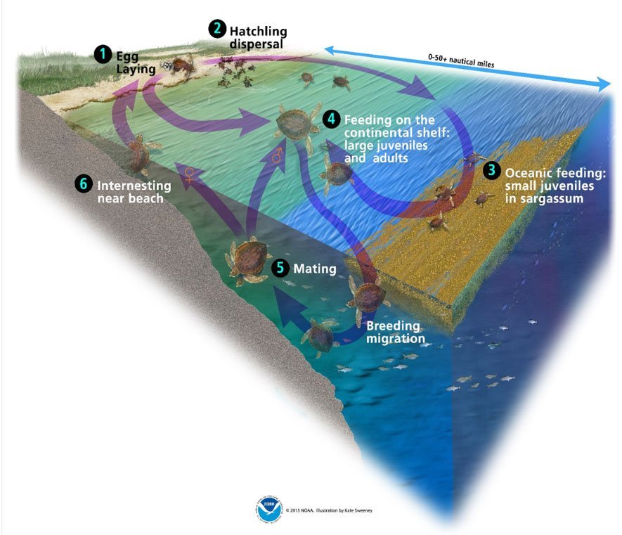
With the exception of basking green turtles in Hawaii, the only time turtles crawl ashore is for the females to lay their eggs. Females lay their clutches of eggs every 2-4 years on beaches, then return to the ocean. The embryos develop buried in the sand for around 45-60 days. Hatchlings emerge from their nests, quickly crawl to the surf, and begin a marathon swim to find refuge within offshore areas.

Juveniles, Surface-Pelagic Life Stage
Most post-hatchling turtles live at the surface of the open ocean. Turtles at this stage have limited diving ability, and spend more than 80% of their time at or near the surface.

Large Juveniles and Adults
Large juvenile and adult sea turtles spend most of their time in shallower water, along the continental shelf or nearshore environments. At this age they have developed into active swimmers, diving frequently to depths greater than 65 feet.

Sea turtles have extremely accurate navigational systems that allow them to migrate between widely separated feeding and breeding grounds.

Keeping a weather eye open

keeping-a-weather-eye-open

"Scoff if you will Mateys! ...but after reading this you'll keep a weather eye on the waters round yer vessel when anchored!"

IDIOM: keep a (or one’s) weather eye open. To keep watch; stay alert.

The American Heritage Dictionary of the English Language http://www.bartleby.com/61/21/W0072100.html

“weather eye”  NOUN: An ability to recognize quickly signs of changes in the weather.

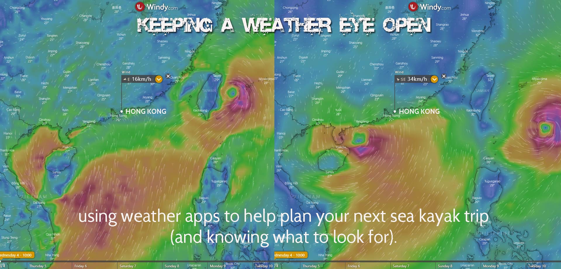
As a sea kayaker, you should work on developing a good “weather eye” (along with all your other seamen’s tricks).  Various sights, sounds and smells can tip you off to changes that portend trouble. All you have to do is learn what they are for your kayaking area and keep that weather eye peeled. 

What to look for here in Hong Kong.
The weather is the most important criteria for planning when going sea kayaking. The kayaker who paddles without knowing the weather forecast is just asking for trouble.

Winds & the kayaker

When things go wrong for kayakers at sea, it’s usually because of a little too much wind.
Sea kayaks cope very well with waves, tides, currents and extremes of temperature, but too much wind can be a real problem. 

If the day of your trip is windy, you can avoid problems by changing your plans. Shorten the trip. Move it to a small estuary with wooded sides, or the downwind side of a headland. On a windy day, paddle upwind to start with so if anybody gets tired, the group will have an easy downwind ride back to where you started from.

If you are out kayaking and a strong wind is blowing right in your face, keep up the pace until you get to shelter. 
If you go slowly you will be out there struggling for a lot longer. If you stop for a rest you will drift backwards faster than you expect. A 10-minute rest on open water in a strong wind can cost you an extra 20 or 30 minutes paddling.

Also, wind creates waves. When a strong wind blows out to sea, the water may be smooth inshore but increasingly rough as you get further away from the beach. And the further you go out to sea, the rougher the sea and the stronger the wind. An onshore wind blowing a long distance over water can create a heavy surf which makes things difficult or even dangerous, especially when exiting the ocean. Knowing how to surf you kayak is essential in these conditions!

What is the best weather for kayaking?

A cloudy (overcast) day with little or no wind.

Some people are put off kayaking by cloudy days, but that can be the best time to head out. Kayaking in light rain is also quite refreshing and you’re going to get wet anyway, so don’t let a few showers put you off.

When the weather is overcast you don’t get baked by the sun so you tire less quickly and can have more fun kayaking out on the water. This is very important in Hong Kong

Bright sunny days are the most popular time to hire a kayak becuase most people haven’t had the experience of sitting on or in a kayak with no shade in the hot Hong Kong sun. This is infact not the best time to go kayaking. More information about the dangers of over heating while kayaking will be published in a future article.

So, if you are planning a kayaking trip in Hong Kong, or anywhere for that matter, make sure you get the latest weather information, understand it, apply it to the local geography and have a safe fun day on the ocean making sure you always ‘keep your weather eye open”!

Camp Packing List

campfire Lamma Island Hong Kong

Important

Remember when kayaking, everything needs to fit in a very small hatch. Its best to pack things in small bags (NOT big bags).

Also, (funny thing) everything will get wet unless you waterproof it! Duh! 
So it needs to be packed in waterproof bags. So make the bags 15 litres or less so that it fits in the hatches of your kayak.

On Water Clothing

On Water Gear

Cooking Gear

Personal Gear

Sea horses slaughtered in Hong Kong

Used as a natural Viagra in Chinese medicine, seahorse numbers are declining.

By Sarah Lazarus,

CNN Updated 0037 GMT (0837 HKT) June 7, 2019

Hong Kong (CNN)
In a row of shops in Sheung Wan, on the western side of Hong Kong Island, the seahorses are stored in plastic boxes and glass jars, their elongated, S-shaped bodies stacked like spoons.

In Hong Kong, this district is the center of the trade in traditional Chinese medicine — an ancient system that uses dried plants and animal parts to treat ailments.
Its narrow streets are crammed with delivery trucks and men pushing trolleys loaded with crates of dried fungi, herbs, berries — and seahorses.
In Chinese medicine, seahorses are believed to have Viagra-like powers.

Hong Kong is the world’s largest trading hub for the dried animal.

Sarah Foster, program manager of Project Seahorse at the University of British Columbia in Canada, said that analysis of global trade datashows that Hong Kong was responsible for around two thirds of all seahorse imports from 2004 to 2017.

The World Wildlife Fund has reported that their popularity as a medicine is also driving sales in China, Taiwan and Indonesia. While nobody knows how many seahorse are left in the world, experts say they are under threat.

With their miniature equine snouts and beady eyes, seahorses look very different than most other fish. And unusually, it’s the males that get pregnant.

But perhaps more importantly to conservation efforts, these are hard animals to study. Spread across vast oceans, some seahorses are less than an inch long and some can change color to camouflage themselves — making them challenging to spot.

Sheung Wan is the epicenter of the trade in Chinese medicine and dried seafood in Hong Kong.
Foster said that about 37 million seahorses are caught in the wild every year. And despite regulations designed to protect them, smuggling is rampant.

According to Project Seahorse, research carried out around the world shows that populations of at least 11 species have dropped by between 30% and 50% over the past 15 years.

Why are seahorses used in Chinese medicine?
Seahorses were first mentioned in Chinese medical literature in 700AD but their use probably goes back much further, said Lixing Lao, director of the School of Chinese Medicine at the University of Hong Kong.

“According to Chinese medicine theory, seahorse is nourishing … and gives the body more energy,” he said. Mixed with herbs and boiled as a tea, dried seahorses are most commonly used to treat asthma and male sexual dysfunction, including impotence and premature ejaculation, he said.

Lao said there isn’t there any scientific evidence that seahorses could relieve asthma or boost sexual performance, adding that there had not been any clinical trials carried out on humans in this area. 

As a former British colony, Hong Kong sees a mix of both Western medicine and Chinese medicine — there were 7,425 registered Chinese medicine practitioners in the territory in 2017, according to the Department of Health.

Seahorses retail in Sheung Wan for up to 40 Hong Kong dollars ($5) each.

A herbal medicine shop in Sheung Wan. According to the owner, the cat is not for sale.

A shop assistant in Sheung Wan, who declined to give his name, said that from what he has seen, seahorses are mostly bought by men over the age of 50.

Smuggled in suitcases
In theory, seahorses are protected animals.

In 2002, all species were listed under Appendix II of CITES, an international treaty designed to ensure that the international trade in wild animals and plants does not threaten their survival. With this listing, seahorses can be exported only if they have been sourced sustainably and legally, and there is paperwork to prove it.

Some countries, including Thailand, the Philippines and Indonesia, went further and imposed blanket bans on seahorse exports.

But these efforts have not saved seahorses, said Foster. Instead, the bans have created a black market.

Earlier this year, Foster participated in a research project in Hong Kong. Investigators questioned 220 traders about the origin of their seahorse stocks during 2016 and 2017 and found that an estimated 95% were imported from countries with export bans. The traders revealed that Thailand is the number one supplier of Hong Kong’s Chinese medicine shops — despite that country officially suspending exports in January 2016.

Small and non-perishable, dried seahorses are easily smuggled across borders, sometimes in mixed consignments with other dried seafood. Several of the traders in Foster’s project admitted to carrying them in to Hong Kong in suitcases. With the trade now operating in the shadows, “it’s a lot harder for us to monitor, track and manage it,” said Foster.

Seahorses for sale in Hong Kong’s Sheung Wan district.

The Chinese medicine shops in Sheung Wan are not breaking the law in selling seahorses. A spokesperson for the Hong Kong government’s Agriculture, Fisheries and Conservation Department (AFCD) said that CITES measures for seahorses are designed to control import and export, but Hong Kong law does not ban trade within the territory.

The AFCD has been trying to stop the illegal imports. In 2018, Hong Kong authorities seized 45 shipments of incoming dried seahorses weighing a total of 470 kilograms — approximately 175,000 seahorses. The heaviest penalty handed to a smuggler was a four-month prison sentence, said the spokesperson.

Caught in the net
The traditional Chinese medicine market might be fueling demand for seahorses, but if the trade was stopped it would not save them, said Foster. That’s because the underlying problem isn’t Chinese medicine — “it’s the fishing industry,” she said.

By dragging a large net between them, these Thai pair trawlers catch more fish than two boats operating independently.
Foster explained that as relatively rare animals, seahorses are not usually targeted by fishing boats. However, when indiscriminate fishing gear is used, they get scooped up in the nets along with everything else.

Trawl nets — large nets that are dragged along the seabed, catching everything in their path — are the worst offenders. According to Project Seahorse, trawlers drag an area of seabed twice the size of the continental United States, every year.

Trawl fishing is widespread in Africa, Latin America, east Asia and southeast Asia, said Foster, and southeast Asia is a hotspot for seahorses. 

As a valuable item, seahorses are usually retrieved from fishing nets and sold.
Even if the trade disappeared, seahorses would still be caught in the nets, said Foster — which would almost certainly kill them. “Either way, they would be dying,” she added. Foster said the only way to save seahorses is to better manage fisheries — reducing the size of fishing fleets, closing large areas of ocean to trawlers and making greater efforts to keep trawlers out of existing exclusion zones.

CNN contacted Thailand’s Department of Fisheries for their view on seahorse exports and fisheries regulation but had not received a reply at the time of publication.
Foster would also like to see trade bans properly enforced with more rigorous checking of dried seafood shipments.

“Without greater political will, it won’t be possible to stamp out the problem,” she said, adding that she fears that seahorses will be wiped out in some parts of the world.

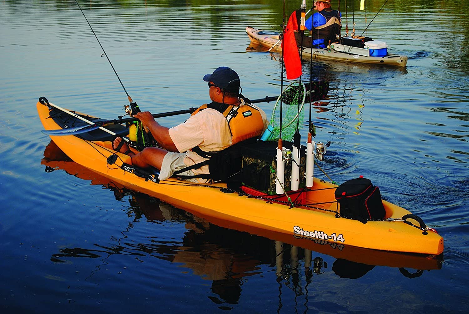
Learn to control your kayak to become a better kayak angler

kayak fishing

Most people who fish from a kayak are anglers NOT kayakers

Listen to the experts. nDo a FREE Fishing Kayak Control Course with Sea Kayak Hong Kong.

Learn how to control your kayak and understand how the local tides, currents and weather effect the fishing conditions.

Understanding how a kayak works is very important.

Fishing is an art form that completely eludes me. On the other hand, kayaking is about science and maths, which makes total sense. So, if being a better kayaker means that you will be a better kayak angler, then lets start with the basics.u00a0

Understanding how the kayak works 101.

A sit-on-top kayak is the perfet type of kayak to use for kayak fishing. These kayaks are completely different to seakayaks which are designed to go on extended journeys across the open ocean. See the features comparison table later in this post.u00a0

The sit-on-top kayak is extremely stable due to its width. This means that it will be slow paddling so do not try and do long distances in these kayaks. The maximum speed you will be able to go on still water is about 3 kms per hour – a slow walking speed.u00a0

Using tides and tidal currents.u00a0
Because the sit-on-top kayak is relatively slow, you will need to know which direction the tidal current is flowing and how fast. The maths is really simple. If you are sitting in a body of water travelling south at 3 kms per hour for 2 hours, you will travel 6kms south. If you have to return home after drifting with the tide, it will take you 2 hours of constant paddling to get back to where you started. Simple uh? Well its a bit more complex than that, but the principle is correct.u00a0
Knowing how the tides effect water flow and how fast and in which direction they are flowing takes local knowledge and some real calculations. This is essential knowledge for your safety and enjoyment. Did I mention safety?u00a0
In Hong Kong there are some very strong tidal currents that can easily flow at up to 10kms per hour. Tat will have a dramatic effect on how you can control your kayak.

Understanding tides and tidal currents is essential seamanship for a kayak angler..u00a0

Understanding how wind and weather can effect a kayak on the water 101.

The sea is made of water. Water is a slippery liquid. The wind will blow the kayak across the slippery surface – simple logic. So, knowing which way the wind is blowing from and how fast is essential for you to know where to paddle your kayak, if you don’t want to be blown away.

Understanding how local topography effects wind direction and speed is also important knowledge for a kayak fisherman or woman.

So it should now be fairly obvious that during your time on the kayak on the wateru00a0there will be things that effect it.u00a0Unless you want to be drifting along at the mercy of the wind and tidal currents,

you will need to know how to anchor the kayak to stop the drift AND paddle the kayak effectively to get to and from where you want to go!

To gain this knowledge requires 2 seperate parts to learn the essential seamanship skills for a kayak anler.

The first part is to understand the theory. This can be done online mostly. Sea Kayak Hong Kong will be developing an online kayak seamanship course in the near future that will allow you to learn these fundamentals in your own time.

The other part is to put the theoretical information into practice AS WELL AS learn the fundamentals of effectively paddling and controlling your sit-on-top kayak.

Seamanship Terminology

seamanship

A  guide to kayak & nautical terms. What is it and why is it important?

 The letter A

Abaft

Behind, toward a vessel’s stern.

Abeam

Off the side, amidships, at right angles to the fore and aft line.

Adrift

Not made fast, floating loose, at mercy of wind and current.

Aft

A directional term indicating the rearward or back area of the vessel. Opposite of fore.

Aground

Touching or stuck on the bottom.

Ahead

In front of the vessel, forward; opposite of astern.

Aloft

Above deck, usually in the rigging.

Amidships

In or toward a vessel’s middle part, between the sides or between bow and stern.

Anchor

Device used to secure vessel to bottom of body of water.

Astern

At any point behind the vessel, backward.

Athwartship

At right angles to the fore-and-aft line of a vessel.

Aweigh

The position of anchor as it is raised clear of the bottom.

B

Back

Change in direction of the wind in counterclockwise direction, opposite of veer.

Ballast

Extra weight carried low in a vessel to increase stability.

Batten Down

Secure hatches and loose objects both within the hull and on deck.

Beacon

A marked post located on a shoal or bank to warn vessels of danger or to mark a channel. A signal mark on land; a light or radio signal.

Beam

1. The widest part of the vessel. For example a typical beam of a kayak is 22 to 24 inches.

2. A horizontal athwartship support for the deck.

Bear Off

Steer away from the wind, shore or any object.

Bearing

The angular direction in which an object is observed with respect to a reference direction or another object , usually yourself

Belay

1. Secure a line without a knot or hitch.

2. Command to stop or cease action, as in “Belay that, sailor!”

Below

Beneath the deck.

Bend

1. Secure a sail fast to a spar or stay.

2. Knot to secure a line to another line or object such as an anchor.

Bight

Open or closed loop in a line or rope.

Bilge

The lowest part of the vessel’s interior.

Bollard

Stout post on wharf or pier for securing mooring lines.

Boot Top

A painted line that indicates the designed waterline.

Buoyant

An object is positively buoyant when the density of the object is less than that of the fluid it is in. Positively buoyant objects float, negatively buoyant objects sink.

Bow

The sharper end that usually goes first.

Broach

The turning of a vessel broadside to the wind or waves, subjecting it to possible capsizing.

Bulkhead

A vertical partition or wall.

Bulwark

Extension of topsides above deck. Kayaks don’t have any.

Buoy

An anchored float used for marking a position on the water or a hazard or a shoal and for mooring

C

Capsize

To turn over, upset.

Cast Off

To let go a line, as to cast off a bow line.

Center of Buoyancy

In mechanical physics, this is the averaged spatial location of the force of buoyancy acting upon a object.

Center of Gravity

In mechanical physics, this is the averaged spatial location of the force of gravity acting upon a object. For objects small compared to the variation in the gravity field, this is at same location as the center of mass.

Center of Mass

In mechanical physics, this is the averaged spatial location of the mass of the object. The motions of the entire body can be described by the motions of this point trough space and the rotation of the body around this point.

Chine

The chine is an angle on the bottom of the vessel where the flair decreases as the hull transitions from the bottom of the vessel to the sides.. A hard chine is where that angle decreases rapidly making a sharp angle. A hard chine kayak has a well defined turn where the “V” comes up to the side. This hard chine gives a unique feel to a kayak giving very good stability even in a narrow craft.

Below is a schematic of a hard chine. Round hull vessels have no chine.

Chock

1. A heavy fitting of metal or wood with two jaws curving inward, through which a rope or cable may be run.

2. A block or wedge placed under something else to keep it from moving

3. To fit with or secure by a chock

Cleat

A fitting, secured to the deck, mast, or spar, having two projection horns to which lines are made fast.

Cleopatra’s Needle

Position of the kayak when one end fills with water and the other end sticks up in the air. Kayak is rendered useless. z

Coaming

The raised edge around the cockpit. Its primary purpose is to divert water from entry into the cockpit area. In touring and whitewater vessels, a fabric skirt is placed around the coaming to keep water from entering the cockpit when the edge of the cockpit is below the water.

Cockpit

Well or sunken space in the deck. A semi-enclosed area where the paddler sits.

Compass Error

Combined effect of variation and deviation.

Course

Intended direction for a vessel to travel.

Course Made Good

Actual vessel track or course after adjusting for such factors as current and leeway.

Cross Section

The cross section is the shape of the kayak from one side to the other, perpendicular to its center line. A round hull is extremely fast but very unstable where a flat hull is initially stable but very slow. Flared sides give comfortable secondary stability because of added buoyancy when leaning to the side. A “V” bottom vessel has a defined angle at the keel.

D E

Deck

Horizontal covering resting on the deck beams of a vessel, the floor of any compartment.

Density

The mass of an object divided by its volume.

Deviation

Differences between the compass reading and an actual magnetic direction caused by magnetic forces in the vicinity of the compass, which are usually the result of masses of metal, speaker magnets, etc

Displacement Hull

A type of hull that plows through the water, displacing a weight of water equal to its own weight, even when more power is added

Draft

The depth a vessel sinks when afloat, as measured vertically from the water line to the lowest point. The vessel needs this much water depth or it will be aground.

Drogue

Object streamed from vessel to decrease speed.

Ebb

A receding current.

F

Fair-lead

Fitting to route control lines or cables.

Fish Form

Describes a hull form where the beam (widest portion) of the hull is in the front half of the vessel, often in front of the paddler. Its opposite is the swede form.

Flare

Flare is the angle that a vessel gets wider as it gets higher. Flared sides give comfortable secondary stability because of added buoyancy when leaning to the side.

Here is a vessel designed with moderate flair in both the

bow

and stern. (CLC Pax 20)

Here is a vessel with extreme (or strong) flair in both the

bow

and stern. (CLC Pax 18)

Flood

A incoming current.

Following Sea

An overtaking sea that comes from astern.

Fore

A directional term indicating the forward or front area of the vessel. Opposite of aft.

Freeboard

The distance between the waterline and the lowest point of the deck of the vessel

G

Give-Way Vessel

That vessel which, according to the applicable Navigation Rules, must give way to the stand-on vessel. Superseded the term burdened vessel.

Ground Tackle

An anchor and anchoring gear.

Gunwale

Pronounced “Gun’l”. The top outside edge of an open vessel such as a canoe or row boat. Where hull and deck meet for vessels with a deck.

H

Hatch

An opening in a boat’s deck fitted with a watertight cover.

Head

1. A vessel’s toilet.

2. The upper corner of a triangular sail.

3. The foremost part of a vessel.

Heading

Direction in which a vessel is pointing at a given moment.

Headway

Forward movement or the rate of forward movement

Heave

1. To throw, as to heave a line ashore.

2. The rise and fall of a vessel in a seaway.

Heave To

To bring a vessel to a position where she will maintain little or no headway, usually with the bow into the wind or nearly so.

Heel

The leaning of a vessel to one side such as caused by the wind.

Hitch

A knot used to secure a rope to another object or to another rope, or to form a loop or a noose in a rope

Hull

The main body of a vessel exclusive of spars and rigging.

I J K

Inboard

1. More toward the center of a vessel; inside. Opposite of outboard.

2. A motor fitted inside a boat. Opposite of outboard

Jetty

A structure, usually masonry, projecting out from the shore; a jetty may protect a harbor entrance

Keel

A ridge or projection on the very bottom of the vessel. The keel may be very indistinct in a narrow “V” bottomed vessel or nonexistent on a flat bottomed vessel.

Knot

1. A nautical mile-per-hour measure of speed. A nautical mile is approximately 6076 feed. (A stature mile is 5280 feet.)

2. A means of joining two lines together or fastening a line to an object.

L M N

Latitude

Parallel lines indicating the number of degrees in the angle between the Earth’s axis of rotation and a line perpendicular to that axis. (The equator) The equator is 0 degrees. The North and South poles (rotational axes) are 90 degrees North and 90 degrees south respectively. The distance between lines of latitude are constant. Lines of latitude are easily determined from measuring the angle of the sun and knowing the date.

Lee

A calm area behind a solid object that blocks the wind.

Lee Shore

Shore which offers protection from the wind or current. Opposite of windward shore.

Leeward

Direction away from the wind: Downwind. pronounce loo-rd

Lie To

1. See heave to

2. Behavior of a vessel when anchored e.g. lie to anchor

List

The leaning of a vessel to one side caused by misplaced or shifting ballast or a leak.

Longitude

Great circle lines measuring the angle between the zero meridian, designated as running directly north-south through the Royal Observatory in Greenwich England from 0 degrees to 180 degrees either east of west of the zero meridian. The distance between lines of longitude are not constant. Longitude is easily determined by measuring the time of the sun’s zenith. Knowing the time accurately was a big problem for earlier navigators.

Lubber’s Line

A mark or permanent line on a compass indicating the direction forward parallel to the keel when properly installed.

Mooring

An arrangement for securing a boat to a mooring buoy or a pier.

Midship

Approximately in the location equally distant from the bow and stern

Nautical Mile

Unit of distance equal to 6076.1 feet. Original intended to be 1/24000 of the circumference of the earth at the equator.

O P Q

Outboard

1. Toward or beyond the boat’s sides. Opposite of inboard.

2. A detachable engine mounted on a boat’s stern. Opposite of inboard.

Overboard

Over the side or out of the boat.

Painter

A line tied to the bow of a dinghy for towing or making fast.

Pier

A loading platform extending out from the shore.

Pitchpole

Capsize end over end. Not fun when unintentional.

Piling

Support, protection for wharves, piers etc

Plan View

The shape of the vessel looking straight down from the top. From this view you can easily see the widest part of the vessel. This is usually at deck level near the cockpit. A swede form kayak has a cleaner, longer slender entry giving easy touring speed and maneuverability. A fish form kayak may have a slightly blunter entry but will have a more slender exit through the water which increases tracking, even in adverse conditions. The actual performance of the kayak will be determined by the waterline shape, not the deck shape.

Planing Hull

A type of hull shaped to glide easily across the water at high speed

Port

1. The left side of a vessel, looking forward. Opposite of starboard.

2. A place in which a vessel can find shelter.

3. An opening in the side of a vessel.

Quarter

After part of a vessel’s side (port quarter, starboard quarter).

R

Relative Bearing

Direction of an object relative to a vessel’s heading.

Rocker

The curve on the bottom of the vessel along the center line from the bow to the stern. Think of the bottom of a rocking chair.

The more rocker the easier the vessel will turn. The less rocker the harder it is to keep the vessel going straight. A whitewater vessel usually has a lot of rocker because quick turns are important. A touring kayak has very little rocker along the bottom, allowing the vessel to be paddled over long straight courses. When a turn is needed, leaning the kayak produces rocker from the curve on the sides of the kayak.

Running Lights

Lights required to be shown on boats underway between sundown and sunup

S

Scope

The ratio of length of an anchor line to the depth of water. The “depth” includes the height of the chock above the water, sometimes thought of as the length of rode.

Sea Anchor

Device used for slowing a vessel down. See drogue.

Set

Direction toward which the current is flowing.

Skeg

An vertical projection under the hull used to maintain directional control.

Slack

A rope or line not under tension, often drooping.

Slack Water

Minimum velocity of tidal current

Stand-On Vessel

That vessel which has right-of-way during a meeting, crossing, or overtaking situation. Superseded privileged vessel.

Starboard

The right side of a vessel looking forward.

Stem

The leading edge of a vessel’s hull.

Stern

The blunter end that usually goes last

Stow

To put an item in its proper place.

Swamp

1. To fill with water.

2. Land that at least periodically is flooded

Swede form

Describes a hull form where the beam (widest portion) of the hull is in the back half of the vessel, often in back of the paddler. Its opposite is fish form.

T

Tide

The diurnal rise and fall of water level in the oceans due to the rotation of the earth and moon around each other.

Tracking

Tracking is a description of a kayaks ability to go in a straight line without compensation from the paddler.

Trim

1. The longitudinal balance of a vessel. If either the bow or the stern is depressed, the vessel is said to be down by the bow or down by the stern.

2. To adjust the set of a sail.

Tumble Home

The amount of “tuck” or angle as the hull of the vessel narrows toward the stern just above the waterline.

V

Variation

Magnetic variation. The difference, east or west, between magnetic north and true north, measured as an angle. Magnetic variation varies in different geographic locations

Velocity Made Good

Actual vessel speed after adjusting for such factors as current and leeway.

Veer

Wind veers when its direction changes clockwise. Opposite of back.

Volume

Kayaks are designed in a number of sizes, lengths, widths and shapes. A useful common measure when comparing them is to look at their total volumes. Total volume is a fairly accurate indicator of a kayak’s gear carrying capacity. How the volume is distributed has a significant influence on the storage volume available. For instance a kayak with fine ends and a high amount of volume in the cockpit area would have less usable storage capacity than a vessel with a more equal volume distribution. Storage can also be better in kayaks that have more volume in the ends as it is easier to pack more items into the bigger ends.

W Y

Wake

The disturbed water following a moving vessel.

Wash

The rush or sweeping of waves on a bank, shore or vessel.

Waterline

The line on the hull of a vessel to which the surface of perfectly calm water rises when the vessel is motionless.

Way

Movement of a vessel through the water such as headway, sternway or leeway.

Weather Cocking

The turning of a vessel due to the action of the wind.

Wetted Surface Area

The actual area of the hull that is in contact with the water. The more wetted surface area, the more effort required to move the vessel through the water. A narrow, rounded hull shape minimizes wetted surface area. Carried to extremes, the kayak can become too narrow to sit in or too unstable to paddle.

Wharf

Man-made structure parallel to the shoreline for loading, unloading or making fast.

Whipping

Method of binding the end of a rope with small twine.

Windage

A general term describing the amount of exposure of an object to the force of the wind.

Windward

The direction from which the wind is blowing. Opposite of leeward.

Yaw

To swing off course, caused by the action of waves or poor steering.