Sea Kayak Adventure Group

Ocean Litereacy International (Hong Kong)

Sea kayak food journey – for the foodies, an easy beginners paddle.

Yin Tim Tsai UNESCO Global Geopark

Sea kayak food journey - for the foodies, an easy beginners paddle.

What to expect

This is not your average sea kayak trip – which usually includes bringing your own food (see pic above), but it is the perfect beginners trip to build up some sea miles. *****Please note that you have to have gone through the basic sea kayaking course to join this event / know how to control a kayak. This is to make sure the day is enjoyable for everyone.

It seems lately, some of our more experienced members have been taking short sea kayak journeys and stopping at waterfront restaurant enjoy the local cuisine instead of self-catering. 
Well, Edith (Madame Edith to her friends!), our resident foodie wants to share this experience with other paddlers – so if you are a foodie and a budding sea kayaker, join a short but enjoyable paddle around Sharp Island via Yin Tim Tsai for “noodles at the church”.

This journey will take in the mangroves and salt pans of Yin Tim Tsai so, it also has a touch of culture and environmental education to boot! ;-).

As always, normal club rules apply.
Sea Kayak Rental – if needed, $300.

What to bring.
Clothes to kayak in – wet shoes or trainers are a requirement.
Bring a light windproof shell to wear in the afternoon as it is getting cool.
A water bottle and a picnic lunch.
A winning attitude, a smile and a sense of adventure.

Location.
Yin Tim Tsai & Sharp Islands

Circumnavigate Kau Sai Chau

remote beaches only reachable by boat.

Circumnavigate Kau Sai Chau

What to expect

This will be an all-day paddle from Sai Kung town, past Sharp Island and around Kau Sai Chau. This will be a fairly long paddle in potentially challenging conditions – so good for intermediate and more experienced paddlers.

The route takes us passed Whiskey Beach, a favourite place to swim and snorkel. 
We will also paddle between the two islands ( Jin & Kau Sai Chau) through the Kau Sai channel into the open waters of Rocky Harbour. Here we will probably stop on Drone Island to rest and snorkel the coral reefs.
Our return journey keeps Grave Island on our right as we re=enter the Sam Nga Hau with Sai Kung in our sights.

All the normal club rules apply:

1. The trip is free – but if you don’t own your own kayak it will cost HK$300 to hire equipment to be paddling in.
2. We have a 48-hour rule whereby if you do not give us 48 hours notice of your cancellation you will be removed from the group.
3. We need forward payment to secure the equipment hire.
4. Bring everything you need for the day – INCLUDING LUNCH.
5. Make sure you have dressed appropriately and have a change of clothes, a hat, sunscreen, wet shoes and drinking water. NO SINGLE USE WATER BOTTLES, please!

Location.
UNESCO Global Geopark, Sai Kung.

Full moon camping trip – Tung O, High Island UNESCO Global Geopark

Sea kayak camping trip

SEA KAYAK HONG KONG

OCEAN LITERACY INTERNATIONAL

Ocean Litereacy International (Hong Kong)
Sea kayak camping trip

Full moon camping trip - Tung O, High Island UNESCO Global Geopark

Date: Sunday, October 24, 2020.   Hosted By: Dave.  Meeting Place: 10:00 AM, Sai Kung Carpark.

What to expect

Due to popular demand and the success of our last camping trip, we celebrate our return to the ocean with a 2 day exploration camping trip of the outer Shelter Bay coast.
The forecast, although too far out to be too accurate shows we are still in our summer pattern of winds from the south – warm & humid days and nights.
The plan is to take off from Sai Kung early – by 10:30 am and paddle directly to our campsite at Tung O, High Island. This will be about a 2 hour paddle, but we will stop once for a break and swim (to cool down on a hot day). Once at the campsite, we will have lunch and offload our camping gear.

The afternoon exploration will be determined by the wind and sea conditions out passed the outer islands, but our main destination will be Po Pin Chau & Long Ke Wan. This will be a long first day, but the club hasn’t visited here for more than 3 years, so will be another unique and beautiful trip.
Our overnight camp will be under the light of a full moon!

Day 2 and our return to Sai Kung will easier and more relaxed. Probably a brief swim at Basalt Island and depending on the wind and weather will be a relaxed paddle home. Shelter Bay is always a great day out.

Download our camping checklist here – https://seakayakhongkong.com/sea-kayk-packing-check-list/

All the normal club rules apply:

1. The trip is free – but if you don’t own your own kayak it will cost HK$300 per day to hire equipment to be paddling in.
2. We need forward payment to secure the equipment hire.
3. Bring everything you need for the expedition – reference our camping equipment checklist at https://seakayakhongkong.com/sea-kayk-packing-check-list/
4. Make sure you have dressed appropriately and have a change of clothes, a hat, sunscreen, wet shoes and drinking water. NO SINGLE USE WATER BOTTLES, please!
5. Limited camping gear is available for rental if you do not own your own.

FIND Us

Street Address:
Yung Shue O Village
Sai Kung
New Territories, Hong Kong SAR

Phone / whatsapp:
+852 55063620
Email: info@seakayakhongkong.com

CONTACT Us

Sai Kung to Pak O – UNESCO Global Geopark (or return)

resting on a hot day

Top 5 easy sea kayak trips in Hong Kong - #4

Sai Kung to Pak O – UNESCO Global Geopark (or return)

A full day trip - 6 hours kayaking.

This trip can be done in most conditions – except when the the wind is from the south-east and south, blowing greater than 20 km per hour.

This is a longer sea kayak journey than the others, but because of the mostly sheltered nature of the route, it is still regarded as an easy trip, although absolute beginners may struggle with the distance of 15 klms.

This is a true sea kayak journey beginning in Sai Kung at the same location as the Inner Shelter Bay kayak trip but travelling 1n one direction to the outer islands (no returning back to the starting point) terminating in a quiet, remote sheltered cove on the edge of the South China Sea. 

Leaving Sharpe Island behind (see inner shelter bay kayak trip for details) we continue heading south eaast, along the shores of Kau Sai Chau.

Our paddle takes us through another floating fishing village, this one caters to the greater Hong Kong restaurant community whereas the fishing village in Sok Kwu Wan caters solely to the local waterfront restaurants. From here we head to Dog Island to meet our friendly inhabitants and stop for a brief swim to cool down from the intense heat of Hong Kong. It is best to take snacks and water for this journey, but also to take some food for the local dogs. They always appreciate it.

Relaxing on this remote white sand beach on a totally deserted island makes you wonder why more development hasn’t occurred. Whatever the answer to that question is, we all hope is continues to prevail. This is a quiet retreat only minutes away from one of the world’s most cosmopolitan cities. 

Your return journey takes you back into to the East Lamma Channel, this time heading south along the coastal cliffs into the sheltered waters of Sok Kwu Wan. The trip covers a total distance of 7 kilometres in mostly protected waters. 

This is a sea kayak trip that highlights the contrasts that make Hong Kong such a unique destination. 

You are paddling to a remote and totally undeveloped, deserted island less than 2 kms away from Hong Kong Island itself, with over 1.2 million people. The city of Hong Kong is made of towering skyscrapers of glass and concrete, but the villages you visit on this trip are made up of 1, 2 or 3 story buildings constructed of adobe mud and ming dynasty bricks. You will paddle past high speed catamarans and luxury multi-million yachts while watching local fisherman dressed in drab cotton shirt and pants, wearing a bamboo shade hat, controlling their san pan with a long stick of wood shaped as an oa,r hanging from the back of their boat! You’ll see birds diving for fish then roosting on on steel railings that follow the concrete trails that lead from village to village. There are no roads on Lamma Island. Not one single car!

This is a unique, easy sea kayak trip that highlights the past present and future of Hong Kong. 

RECENT ARTICLES

keeping-a-weather-eye-open
News
DaveWilson

Keeping a weather eye open

“keeping a weather eye open” refers to changeable conditions. for sea kayaking that is obvious. it can also be political or other sensitive behaviour.

Read More »

Top 5 easy sea kayak trips in Hong Kong

CSR Corporate event Hong Kong

Get the latest information directly to your inbox!

Follow us

Tai Tam Wan, Hong Kong Island

Sea-Kayak-Hong-Kong-oCT-01-2018-Tai-Tam-Tour_0

Top 5 easy sea kayak trips in Hong Kong - #3

Tai Tam Wan, Hong Kong Island

A half day trip - 3 hours kayaking.

This 6 km sea kayak trip features the British history and natural beauty of Hong Kong. It also joins the famous Dragon’s Back Hiking Trail for anyone wishing to combine a half day hike with this easy sea kayak trip. 

This trip can be done in most conditions – except when the the wind is from the south-east blowing greater than 20 km per hour. 


The British first settled on the southern coast of Hong Kong Island at a place called Stanley. It is a beachside village and very popular tourist destination, famous for its markets and waterfront promenade. On the northern side of Stanley is a wide, deep bay called Tai Tam (Wan). The Stanley Main Beach in Tai Tam Bay is a very busy watersports centre for windsurfing, dragonboating and water skiing. This coast of the bay is well developed with many luxury villas and even high rise buildings fronting the it.

However, the opposite coast is a total contrast. It comprises a stretch of abandoned villages dotted along a serious of small beaches and forest clad hillsides, flowing creeks and cascading waterfalls. It is this contrast that makes the easy paddle around Tai Tam Wan a beautiful and interesting sea kayak trip. 


Looking south across Tai Tam Bay towards the South China Sea.

The circular route of this kayak trip starts at a semi abandoned village on the northern coast of the bay. The hike down from the road to the waterfront crosses section 7 of the Hong Kong Trail ( a hiking trail running west to east across Hong Kong Island). After a 15 minute descent, it is hard to believe that you are still in Hong Kong – its as if you have plunged back in time.  

Departing the Hong Kong Sea Kayak Club HQ, we follow the coast in a westward direction, paddling inland. This takes us further into the bay, passing abandoned villages, wartime relics (piil boxes designed to defend Hong Kong against the Japanese invasion forces in WW2), traditional Taoist and Buddhist temples. As we progress deeper inland the soft white sand beaches are replaced by muddy mangrove forests and moored luxury yachts replaced by traditional sampans and fishing boats, finally ending at the face of Hong Kong’s largest dam wall – the impressive Tai Tam Reservoir wall. This was the main freshwater source for Hong Kong in the early 1900’s and is still in use today. 

Returning back into the bay we follow the opposite coast passing under the ‘famous’ Redhill Apartments, built in the late 80’s. This was supposed to be the most luxurious housing development in Hong Kong but due to construction issues, beacame a bit of a white elephant. Below these “multi-million dollar mediteranean style homes” live squatters in tents and tin shacks, fishing from abandoned boats and windsurfers washed ashore in past typhoons. The contrast is staggering – but as we say here – this is Hong Kong!

If the conditions are suitable, we round the Redcliff headland, passing by the old obelisk built sometime in the 19th century, back into the main section of Tai Tam Bay. The coastline here is more eroded, pulverised by the large swells that enter the bay from the south east. Small sea caves are tempting to paddle into if the day is calm. Stanley is now back in view on our right as we change directions one more time and paddle back across the bay. Our destination is a beautiful beach on the northern coast for a brief break, snack and a swim before returning back to the sea kayak base.

The Dragon’s Back Hiking Trail runs along the ridge behind the kayak centre and is easily accessible from here. As a bonus for people wishing to start or finish their day exploring Hong Kong’s rich natural environment, combine hiking one of Hong Kong’s most famous and beautiful trails with this easy and diverse sea kayak trip.

RECENT ARTICLES

keeping-a-weather-eye-open
News
DaveWilson

Keeping a weather eye open

“keeping a weather eye open” refers to changeable conditions. for sea kayaking that is obvious. it can also be political or other sensitive behaviour.

Read More »

The top 5 easy sea kayak trips of Hong Kong.

CSR Corporate event Hong Kong

Get the latest information directly to your inbox!

Follow us

The Inner Islands of Shelter Bay

ea Kayak Hong Kong Sharp Island Whiskey Beach

Top 5 easy sea kayak trips in Hong Kong – #2

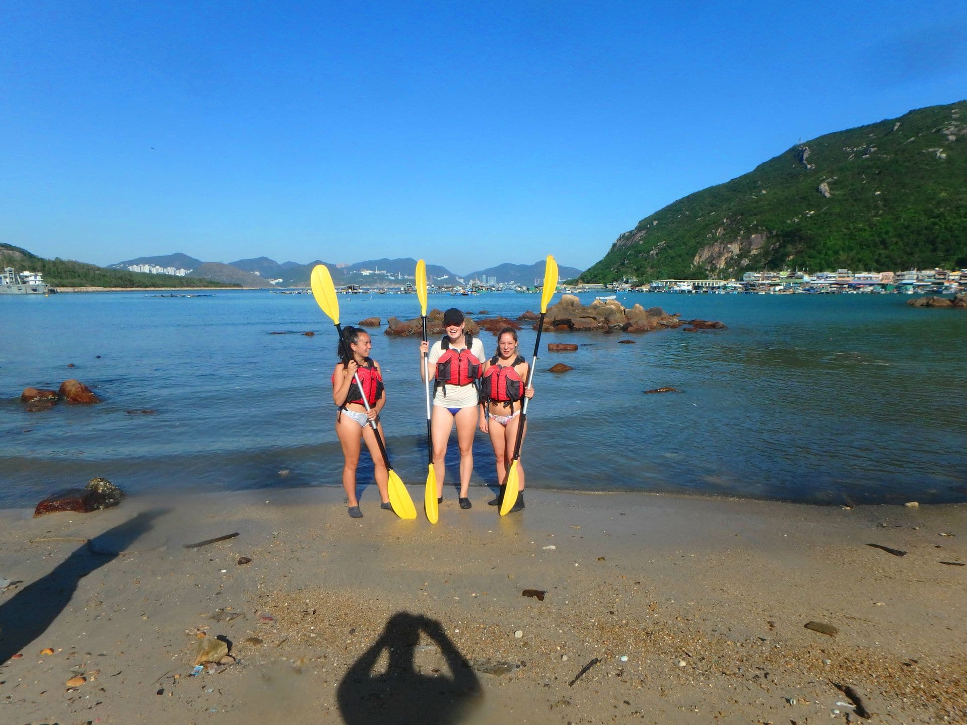
A full day trip – 5 hours kayaking.

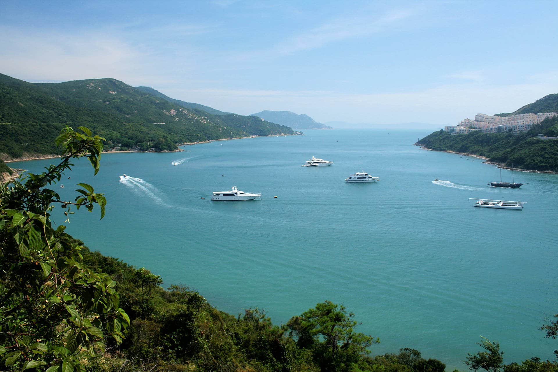
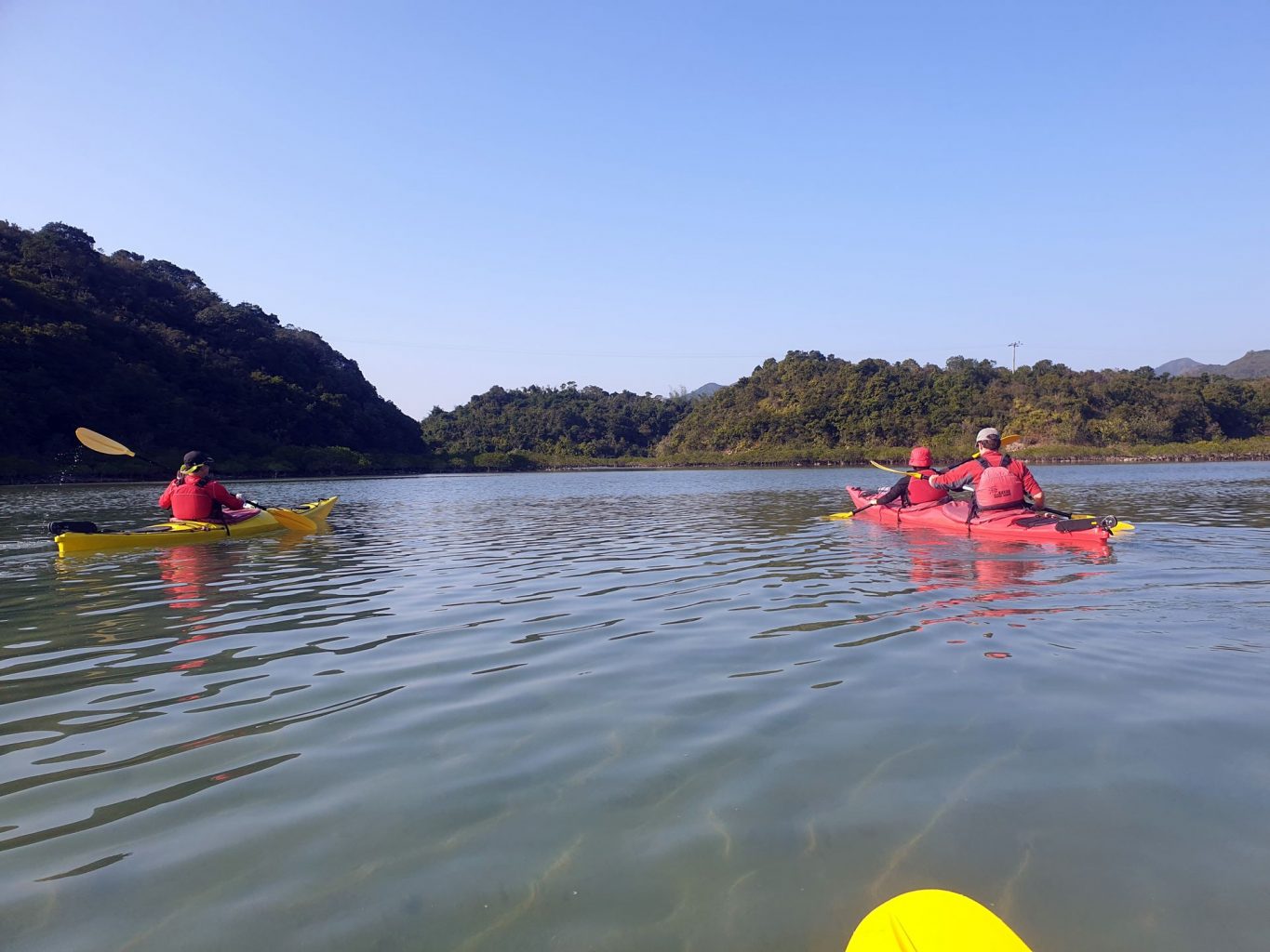
This sea kayak trip is approximately 11 km in length and takes 5 hours. Shelter Bay is aptly named as it is protected is from winds coming from all directions except the south-east. If the winds are strong from the south-east then this is not an easy beginners trip. 

Shelter Bay is part of the UNESCO Global Geopark and as such is one of the most unique places on the globe. 

The Global Geopark was formed by the explosion of a huge volcano 140 million years ago. This cataclysmic event pulverised 70 cubic kilometres of the Earth’s crust, rocketing it into the atmosphere as dust particles. As the atmosphere was still superheated from ‘The Event’, on the return to the surface, the dust still molten, reformed to create a type of volcanic rock called tuff. 

When these dust particles cool slowly they form into crystals. These crystals grow as more particles land, growing five and six-sided columns of volcanic rock. Obviously, these columns grew vertically (gravity), some to heights of 150m or more.  Later, an earthquake tilted these columns at a 10-degree angle so now they sit at 80 degrees to the surface. The volcanic tuff, and these basaltic columns create the amazing coastal features of the UNESCO Global Geopark.

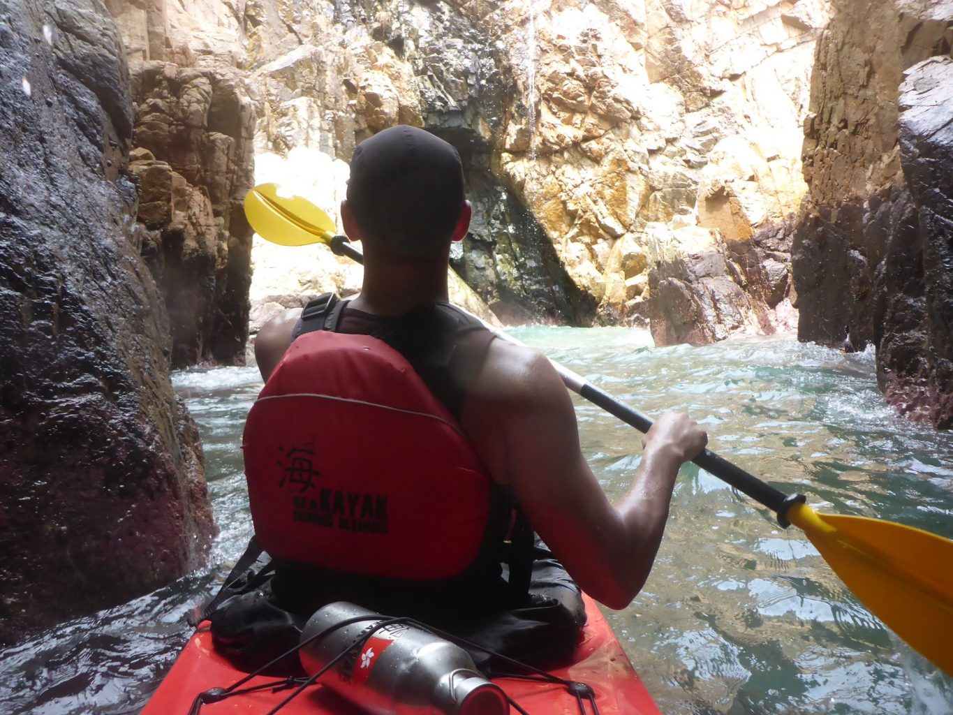
For the sea kayaker, where these columns meet the ocean, is a dramatic seascape. 

As the ocean pounds into these columns of volcanic rock, they wear away the weak points. The weakest points on these coastal features are the joints between the columns. Over the millennia, the ocean has created sea caves, sea tunnels and sea arches through the islands of the Global Geopark. A sea kayaker’s paradise.


UNESCO global geopark Hong Kong

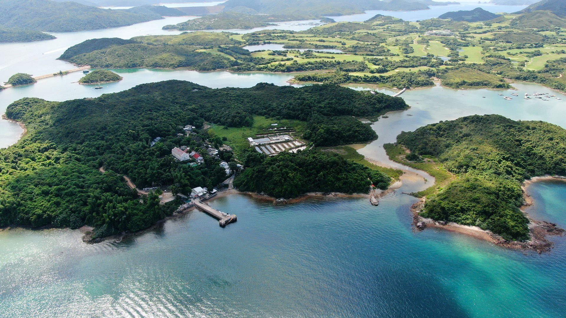
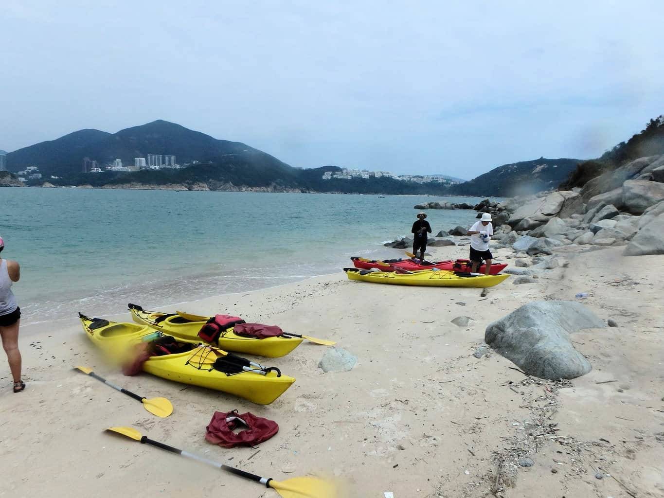
This sea kayak trip departs from Sai Kung, a beautiful village in the north-east corner of Hong Kong. Sitting on the edge of the entire Global Geopark (comprising 9 individual sections) Shelter Bay is the perfect place to commence exploring this unique part of Hong Kong. 

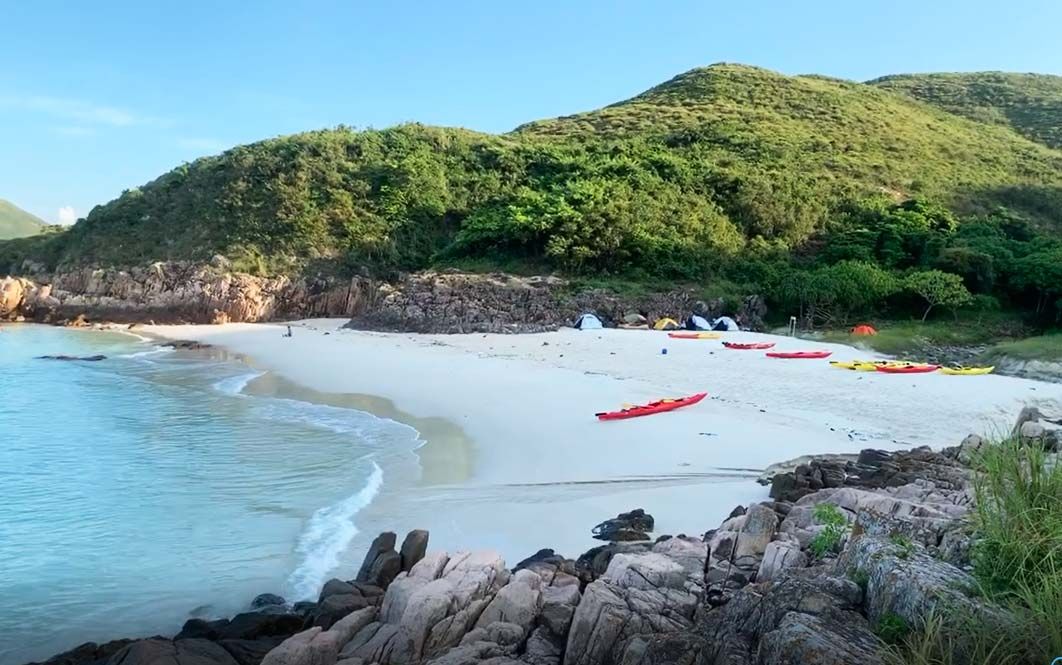
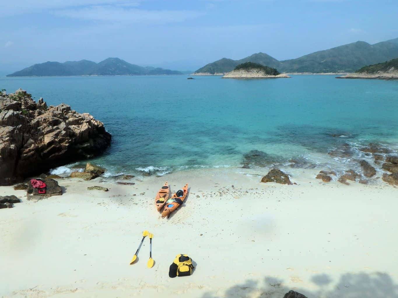
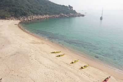
Today you will visit the three islands, by name, Sharp Island, Kau Sai Chau and Yim Tin Tsai. Each Island has its own unique character. Sharp Island is the edge of the volcanic caldera and is now the home to many blossoming colonies of coral reef. It is long and thin with a high ridge running down its spine. It is aligned from north to south with a beautiful white sand beach at either end and some sculpted sea caves on the southern most point.


Sea Kayak Hong Kong Oct 06 2018 Unesco 1 day_26

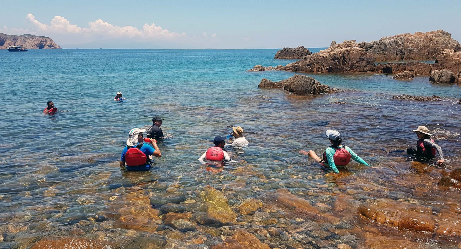
From here, cross to Kau Sai Chau for a very welcome lunch break on the infamous whiskey beach (many stories to be told). As a  direct result of the oceans warming temperatures, we have corals growing abundantly, creating a great place to take a refreshing swim and snorkel. Note! There is still a distinct shortage of fish life in Hong Kong waters (due to decades of over fishing), so don’t expect to be excited by the life under the waves.
The vista here looks south across Shelter Bay towards on Hong Kong island.

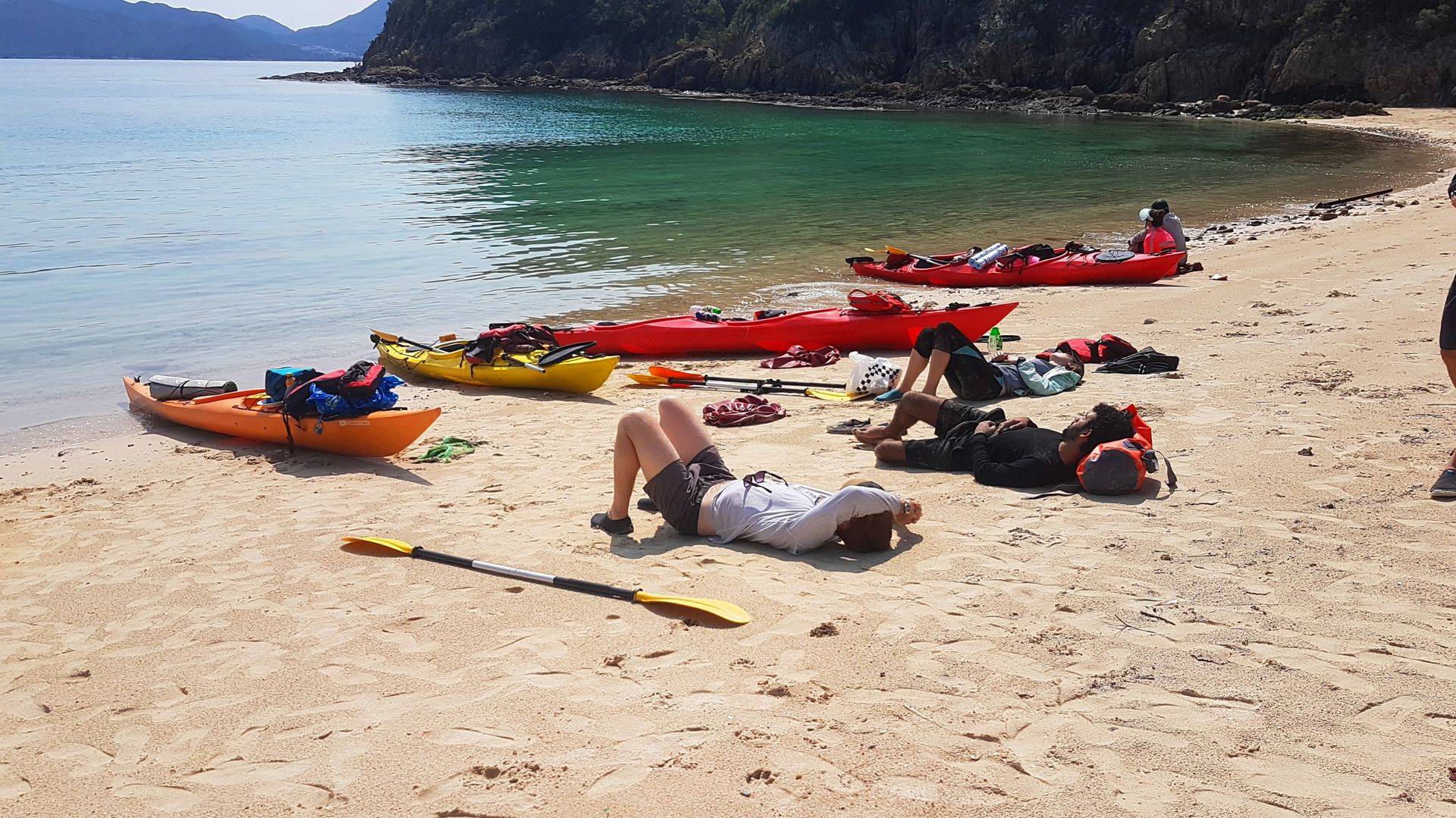
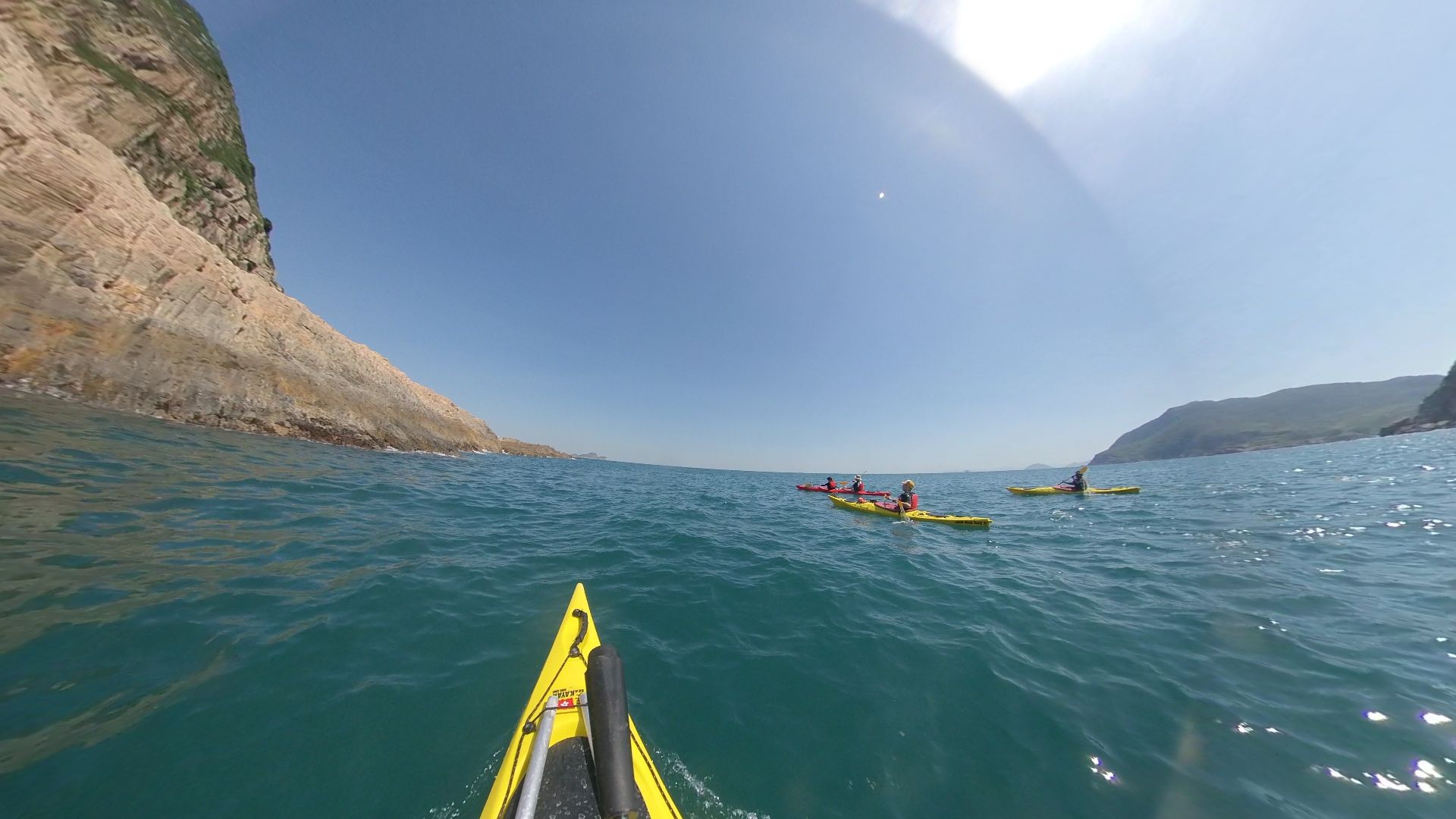
After lunch, we cross back to Sharp Island to land our kayaks and take a short hike up to a vantage point where we can view the places we have been. Returning to our kayaks we paddle north along the coast of Sharp Island until we reach the shortest crossing point between Sharp Is. and Yim Tin Tsai, one of the most historically important islands in Southern China.


whiskey beach, shelter bay, hong kong

The crossing from Sharp island takes us to another unique location. If the tide and sun is right you will paddle over some of the most prolifically growing corals in Hong Kong, alongside a traditional Tanka floating village and a late neolithic stone carving (3,500 years old). Where else in the world is this possible?

Passing through the floating village we enter into a calm lagoon that looks completely landlocked. Take the northen most waterway and you will find a sand bottomed channel with magrove trees on both sides. This is the entrance to the ancient salt flats created by the local Chinese over 2,000 years ago. Once you pass through the mangrove, its time to leave the kayaks to explore the island on foot. This island has been inhabited since 2,000 BC but now is becoming a tourist trap for the mass Chinese tourism market. However, it is worth the visit to see the natural salt fields, old village houses and the feel of an ancient culture.

Back to the kayaks for the last paddle home to Sai Kung, into the sunset and to watch the birds feeding over ‘bird island’, the home of over 50 black kites and 1 dominant breeding pair for white breasted sea eagle. A fantastic end to a glorious day’s paddle.


mangrove channel at Shelter bay


Subscribe Now
Get updated information about sea kayaking in Hong Kong and SE Asia.

RECENT ARTICLES

More Articles

CSR Corporate event Hong Kong

Get the latest information directly to your inbox!

Follow us


Facebook

South Lamma Island – Circumnavigation

remote beaches to sea kayak to

An exposed coast with few takeout places

STH lamma island sea kayak route map

SOK KWU WAN to Lo So Shing Village Beach – east to west sea kayak journey

This trip route will vary (possibly a lot) depending on the tide, wind and ocean conditions on the day. Do not attempt to paddle this section of the Hong Kong coast unless you can self-rescue. There are very few escape routes.

As this trip is 17 klms from start to finish, if you don’t go into beautiful Shek Pai Wan, which would add an extra 3 klms. If the sea, wind and tide conditions are favourable, its a very rewarding to paddle along a largely unknown stretch of the Hong Kong coastline.

So by the numbers:

1. Lo So Shing Village Beach to the East Lamma Channel – 2.58 klms / 40 minutes.
Sok Kwu Wan is a sheltered bay protected on 3 sides by high hills, so unless the wind is coming from the NE, you will not know how strong it is, until you leave the bay.

Point 1 to Point 2 – East Lamma Channel.to Sth Lamma Sea Tunnel – 1.71 klms / 20 mins
The are 2 places in this section that have tidal waves and strong currents, indicated on the map by the yellow wavey lines.These areas can have very confused water at peak tides. 

East Lamma Channel

Just around the headland, if the waves are small, you can explore in close to the cliff face and you will find a surprise – there is a tunnel wide enough to paddle through. This is very easy to miss.

Point 2 to Point 3 – Sea tunnel to Sham Wan beach – 4.76 klms / 60 minutes.
The crossing from the sea tunnel to Sham Wan Headland is relatively straight forward, if you are travelling with the tide. It will take between 30 and 40 minutes, but if the tides are against, this could easily take twice as long.Once you are around the headland and enter Sham Wan (Deep Bay) you gain the protection of the headlands on both sides and quickly find yourself in a sheltered bay (except if the winds are blowing from the south).

The paddle into Sham Wan will take 20 minutes. From July to October the beach is closed to visitors due to the Green Sea Turtle breeding season.Do not land on the beach, instead, paddle 5 minutes back across the bay to a small beach on the opposite side. A great place to swim and have lunch. There is shade too.


Sea Kayak Hong Kong destinations_38

Take your time to have a swim if it is a warm day as there is no place to exit for another 1 hour after departing the lunch beach.


Sea Kayak Hong Kong destinations_33

Point 4 to Point 5 – Sham Wan lunch spot to sea caves around west Sham Wan Headland -2.0 klms / 30 minutes.

Leaving Sham Wan you are again exposed to rugged cliffs and a long headland that juts out into the South China Sea. Here there can be large swells and cross currents depending on the tide. Paddle hard around the headland into the bay behind. You will see a series of cliffs with dark spaces along them. These are sea caves that are worth a visit if the conditions are good.

Point 5 to Point 6 – .Sea cliffs to the waterfall cave – 1.2 klms / 15 mins paddle.
This section is steep sea ciffs all the way. Once around the headland you will see a valley in front of you and what appears to be a dark cleft in the rocky shore. As you paddle towards it, there will be a small waterfall appear (15m) if there has been recent rain. If it is dry, there will be a narrow gap in a cliff appear. This gap is about 4 meteres wide and goes back into a cave that is 30 meters deep, with a steep sandy beach inside. If the water fall is running, you cannot see the cave or the beach. 
NB: you can kayak into this cave and land on the bech if the waves are small. DO NOT go into the cave if the waves are 1/2 meter of greater as you cannot turn around inside and the shorebreak can capsize you when you have to reverse out again.

Point 6 to Point 7 – Waterfall Cave to Millionaires Beach – 2.52 klms / 30 to 120 minutes!!!
This section of the route has the potential of being the most difficult, depending on tide and swell. The cliffs and rocky shores do not allow for a safe landing until you are around the final headland.However, the headland can have a very strong tidal race for about 300 meters. If that is with you, this is a very simple rounding, but if that is against you, it is sometimes faster than you can paddle and will make the section very tiring. Time your journey well!!

Point 7 to Lo So Shing Beach – 1.41 klm / 20 minutes
An easy paddle north to the first beach, however this is a governemnt gazetted beach so it is prohibitted to land there during the swimming season so ensure that you stay close to the southern bank as you addle in. There is a rocky headland with BBQ pits. There is a series of steps leading to the water there. It is a difficult take out poit. Most often it is better to paddle onto the beach and hope that the life guards understand. 

From here the kayaks have to be carried up the stairs at the back of the beach and then trolleyed back to Lo So SHing Village beach – approximately 300m and about 15 minutes hike..


Pak Lap Wan to Sai Kung Village

Bluff Island Sea Arch

An short, fun and beautiful seakayak trip.

Pak Lap to Sai kung sea kayak route

Sai Kung to Pak lap Wan – on a north bound journey OR Pak Lap Wan to Sai Kung on a south bound journey.

This trip route will vary (possibly a lot) depending on the tide, wind and ocean conditions on the day. Do not attempt to paddle this section of the Hong Kong coast unless you can self-rescue. There are no easy escape routes.

Tung Lung Chau to Clearwater bay_10

As this trip is only about 6 klms. If the sea conditions are favourable, its great to paddle into some of the majestic bays and sea caves on the eastern section of the Tung Lung Chau coast before heading north to Clearwater Bay. You also get to see the climbers who scale these cliffs.

Leaving Tung Lung Chau heading north, its a short 500m paddle to the mainland coast, but be aware that this is a busy shipping channel. A major pleasure marina is just around the headland so on a weekend there are hundreds of recreational boats passing through. Keep your eyes peeled for incoming vessels, both left & right.

u00a0

Tung Lung Chau to Clearwater bay_15

From here the cliffs and the hidden nooks and crannies are well worth exploring (depending on sea swells and wind direction of course). There are a number of caves that have been formed along the weaknesses caused by the formation of the volcanic tuff (the reason for the UNESCO listing as a Global Geopark).u00a0

As the constant battering of the waves and swells pounded the vertical columns, the weakest places have let go. Sitting in a kayak on an undulating sea makes you wonder at the power of those waves to cut open these cliffs into such awe inspiring features.

This sea coast is formidable. Make sure that you take opportunities to expore as they arise, but don’t take risks, and always keep an eye over your shoulder for the rogue wave from passing ships or cruisers.

Once inside the more protected waters of Shelter Bay, the coastlines becomes more subdued. The human development on the shores and hillsides are pretty obvious. Within 1 km you are paddling passed the entrance to a very overstated marina development for the uber wealthy of Hong Kong. The attitude of the boat captains can sometimes leave a lot to be desired, so make sure you are obvious and be humble in your attitude to ownership of the ocean on which you paddle and share.u00a0

u00a0

SEA arches of Hong Kong

Entering into Clearwater Bay you are greeted with pleasure vessels of many shapes and sizes. It gives you a sense of acheivement when you realise you have handled the same seas in your small, self-contained sea craft as the multi-million dollar vessels that are at anchor in what must once have been a pristine bay with sea turtles, coral reefs, tropical fish, sea mammals and an abundance of sea life. Today, we have a great place to swim. The ocean is clean and blue, a remnant of bygone days in Hong Kong.u00a0u00a0

The take out point is a long stair climb, maybe 150 steps to an awaiting carpark. The bus leaves here for Hong Kong districts too.

A fantastic paddle for those who want something spectacular and relatively short.

As always, stay safe!

Tung Lung Chau to Clearwater Bay

Tung Lung Chau to Clearwater bay_20

An short, fun and beautiful seakayak trip.

tung-lung-chau-to-clearwater-bay-2

It’s difficult to get to Tung Lung Chau (only by boat) so you would have probably paddled there already – from the previous north bound route – Shek O to Tung Lung Chau.

This trip can either be very easy or extremely difficult depending on tide, wind and ocean conditions. Do not attempt to paddle this section of the Hong Kong coast unless you can self-rescue. There are no easy escape routes.


Tung Lung Chau to Clearwater bay_10

As this trip is only about 6 klms. If the sea conditions are favourable, its great to paddle into some of the majestic bays and sea caves on the eastern section of the Tung Lung Chau coast before heading north to Clearwater Bay. You also get to see the climbers who scale these cliffs.

Leaving Tung Lung Chau heading north, its a short 500m paddle to the mainland coast, but be aware that this is a busy shipping channel. A major pleasure marina is just around the headland so on a weekend there are hundreds of recreational boats passing through. Keep your eyes peeled for incoming vessels, both left & right.


Tung Lung Chau to Clearwater bay_15

From here the cliffs and the hidden nooks and crannies are well worth exploring (depending on sea swells and wind direction of course). There are a number of caves that have been formed along the weaknesses caused by the formation of the volcanic tuff (the reason for the UNESCO listing as a Global Geopark). 

As the constant battering of the waves and swells pounded the vertical columns, the weakest places have let go. Sitting in a kayak on an undulating sea makes you wonder at the power of those waves to cut open these cliffs into such awe inspiring features.

This sea coast is formidable. Make sure that you take opportunities to expore as they arise, but don’t take risks, and always keep an eye over your shoulder for the rogue wave from passing ships or cruisers.

Once inside the more protected waters of Shelter Bay, the coastlines becomes more subdued. The human development on the shores and hillsides are pretty obvious. Within 1 km you are paddling passed the entrance to a very overstated marina development for the uber wealthy of Hong Kong. The attitude of the boat captains can sometimes leave a lot to be desired, so make sure you are obvious and be humble in your attitude to ownership of the ocean on which you paddle and share. 


SEA arches of Hong Kong

Entering into Clearwater Bay you are greeted with pleasure vessels of many shapes and sizes. It gives you a sense of acheivement when you realise you have handled the same seas in your small, self-contained sea craft as the multi-million dollar vessels that are at anchor in what must once have been a pristine bay with sea turtles, coral reefs, tropical fish, sea mammals and an abundance of sea life. Today, we have a great place to swim. The ocean is clean and blue, a remnant of bygone days in Hong Kong.  

The take out point is a long stair climb, maybe 150 steps to an awaiting carpark. The bus leaves here for Hong Kong districts too.

A fantastic paddle for those who want something spectacular and relatively short.

As always, stay safe!